“A blog created by an adopted Franco-Vietnamese for all those seeking to reconnect with their origins.”

Best Hikes Near Nha Trang: Vietnam’s Breathtaking Trails, Canyons & Waterfalls
Discover Vietnam’s most scenic trails: loop hikes, waterfalls, canyon overlooks, and wildflowers—perfect for day hikes and motorbike riders. Updated for 2025.
3/8/20252 min read
Motorbike & Hiking Adventures Near Nha Trang: Forested Trails, Alpine Ridges & National Park Vibes
Trek Through Vietnam’s Hidden Trailheads, Solitary Summits, and Wild River Valleys
If you dream of riding scenic roads to alpine trailheads, then hiking along wooded ridge lines, chasing cascades, and camping near quiet ponds beneath a rising mist — Vietnam’s central highlands are calling.
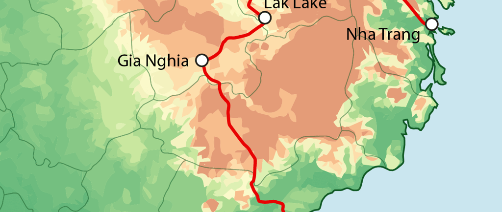
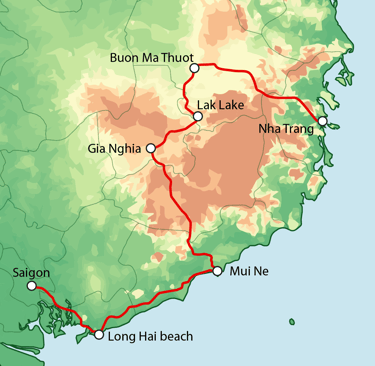
This complete road trip + hiking itinerary takes you from Nha Trang’s coast to the summits of Dalat and the national-forest wilderness of Buon Ma Thuot. It’s where Pacific Crest Trail vibes meet the solitude of the Smoky Mountains, with park trails, river trails, and breathtaking lookouts waiting to be discovered.
Why Ride & Hike in Vietnam?
Because it gives you access to:
Untouched trailheads and highland recreation areas
Scenic switchbacks, bald summits, and glacier-carved ridges
State-park style hikes in remote national-forest terrain
Campsites near meadows, river trails, and wildlife-rich wooded parks
Sunrise hikes for the summer solstice, and peace for your own leave-no-trace journey
It’s not just about the ride — it’s about what you discover along the way.
Full Itinerary: Trails, Peaks & Waterfalls
Hon Ba Ridge Trail & Cascade Lookout
Trailhead access: Motorbike to parking lot, 500m walk to start
Trail type: Loop, with forested climb to ridge lookout
Distance: ~5 miles, moderate elevation
Highlights: Jungle cascade, shady meadows, early morning wildlife
A hidden gem that feels like a mini national-park trail — complete with misty views and river sounds. Ideal for the reflective hiker seeking solitude.
Lang Biang Summit Trail (Dalat)
Trail type: Out-and-back
Distance: 6.5 miles, steep switchbacks
Difficulty: Strenuous
Scenery: Pine forests, rock outcrops, alpine air, panoramic summits
This alpine hike is one of Vietnam’s best for elevation, views, and challenge. It echoes the Pacific Crest and parts of the Great Smoky Mountains, but with Vietnamese soul.
Bidoup-Nui Ba National Forest
Access: Short ride from Dalat
Trail options: River trails, ridge loops, multi-day treks
Features: Dense forested sections, bald hilltops, camp-ready meadows, ranger station
Tips: Bring GPX track or physical map — signage can be minimal
A proper national-forest experience, perfect for those seeking to leave no trace and feel immersed in nature.
Dray Nur Recreation Area & River Trail
Trail: Short, flat, partly paved, forested
Points of interest: Cascade lookout, riverbank path, picnic zone
Distance: ~2 miles round-trip from main parking lot
Good for a relaxed walk after riding. Think parkway access with a Great Smoky feel.
What You’ll Find Along the Way
Remote trailheads far from crowds
Cool breezes on wooded ridges and alpine peaks
Campsites with fire rings and basic water access
Birdsong at dawn, fog curling off the pond
Unexpected solstice moments of peace and introspection
Deep trekking solitude that rivals the best national park trails globally
Hiking Tips (2025)
Respect Leave No Trace principles at all times
Don’t rely on phone service — bring trail maps or GPX files
Be prepared for steep, uphill climbs and bald ridgelines
Watch your footing in wet season — rocks near river trails get slippery
Always pack layers — alpine meadows can feel chilly even midday
Main Menu:
Explorations:
Resources & Immersive Content
Community & Support
Legal & Languages
Contact & Social Networks
✉️ contact@racinesvietnam.com
📱 Instagram | Facebook | YouTube
©️ Copyright
© 2025 RacinesVietnam.com — Tous droits réservés
Site indépendant, créé sans code, hébergé par Hostinger